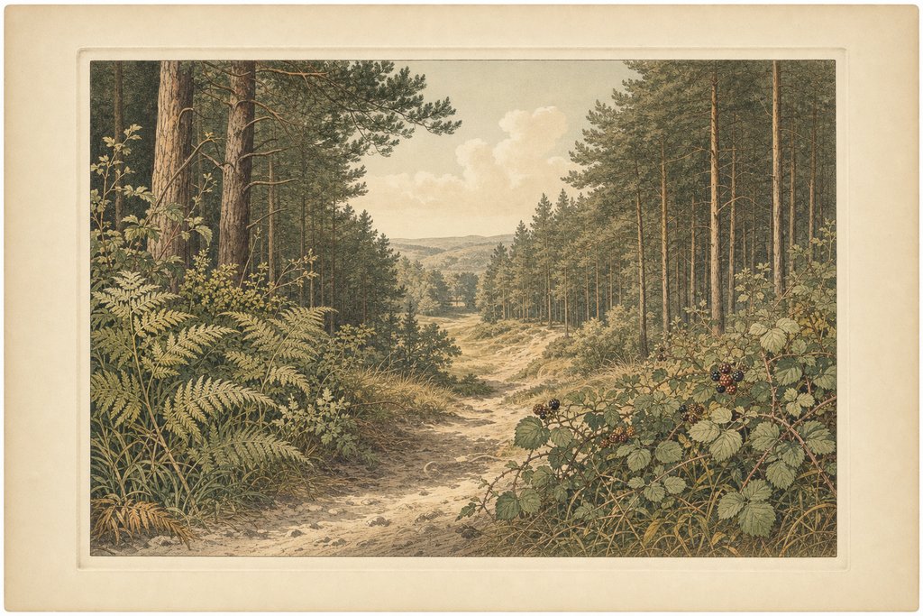
The Firecrest is the long one. The park gives it as over six miles of woodland path and forest track, rising and falling past forest clearings, dense undergrowth and open glades. It is the route that takes you properly into Thetford Forest, well beyond anything that feels like managed parkland.
The park around the start of the walk owes its trees to Edward Bliss, who bought Brandon Park in 1820 with money made from gunflints during the Napoleonic Wars. When that trade declined, his workforce planted more than a million trees. The Firecrest walks out of his collection and into the far larger forest that followed it.
It carried the name Orange Trail until the renaming after 2015, and plenty of printed material still calls it that. The waymarked line is unchanged. Anyone working from an older leaflet should follow the orange discs, which mark the same circuit as the firecrest ones do today on the same posts.
Six miles sounds modest and walks longer than it reads. There is no climb worth the name anywhere on the route, but the ground undulates continuously over low sandy rises, and loose surface takes something out of every step. Three hours is a fair allowance, and four is not unusual with stops.
There is no sensible way to cut this route short once you are past the halfway point. The rides that look like shortcuts on a map lead further into the forest, and improvising a line back across them is how people add an unplanned hour. Turning back the way you came is almost always quicker.
The glades are what make it worth the distance. Plantation pine is uniform and dim, and then the canopy opens onto light, bracken and bramble, and the whole character of the walk changes for a few hundred metres before closing again. Those transitions come often enough to keep the length from feeling repetitive.
Most of what lies beyond the park boundary is Thetford Forest, the largest lowland pine forest in Great Britain at more than nineteen thousand hectares. Its planting began in the 1920s, which makes much of the timber along this route under a century old. Corsican pine is the dominant tree, with Scots pine mixed through it.
Navigation demands more attention here than on the shorter circuits, simply because there are more junctions and they all look alike. Uniform planting removes the landmarks you would normally steer by, and oblique crossings make it easy to leave on a ride one turn off your intended line without noticing for some time.
The bird the route is named for is a genuine Breckland resident, and one of the smallest in Britain. Firecrests favour dense conifer, and this circuit runs through exactly that for much of its length. Hearing one is far more likely than seeing one, and spring gives the best chance by a wide margin.
Conditions swing more here than anywhere else in the park, and they swing within a single circuit. The sandy sections drain within hours of rain and walk well. The hollows under heavy pine hold water for days, and in a wet autumn several stretches stay soft long after the surrounding ground has dried out completely.
Footwear decides a lot on this circuit. Boots with some ankle support cope with the sand and the root far better than trainers, and gaiters earn their place in a wet autumn when the hollows stay waterlogged. A light layer is worth carrying all year, because the glades are warm and the shaded rides are not.
Take water, because there is nothing on the route and no shelter beyond the tree line itself. Phone signal is unreliable across much of the circuit. In winter, start early enough that the light will hold, because the forest goes dark noticeably before the open ground does and the last mile is no place to be guessing at junctions.
Start earlier than the distance suggests. Six miles on this ground takes most walkers close to three hours with stops, and the glades are at their best in low morning light rather than at midday. Winter afternoons run out of daylight under canopy well before they do in the open.
Common questions
Is this the same as the Orange Trail?
Yes. The park renamed its waymarked routes from colours to names after 2015, and the Orange Trail became the Firecrest Trail. The circuit on the ground was not changed. Older leaflets, guidebooks and websites still use the orange name, and both refer to the same route of over six miles.
How long should I allow?
Three hours at a steady walking pace, and four with stops or in soft autumn conditions. The route has no real climb, but it undulates continuously and much of it runs on loose sand, which takes more out of you across six miles than the flat elevation profile would ever suggest.
Can I shorten it partway round?
Not reliably, no. The rides that look like shortcuts on a map lead deeper into Thetford Forest instead of back toward the visitor centre, and none of them is waymarked by destination. Retracing your steps is normally faster than improvising a line across them, which is worth deciding before you set out.
Can I bring a dog on the Firecrest Trail?
Dogs are a common sight on this route, and the forest tracks give them plenty of room. The length is the thing to judge: six miles of loose sand tires older and short-legged dogs well before the end. There is no water point on the way round, so carry enough for the dog as well.
Written by Eleanor Hollis, walks and access editor. The distance and the route description are the park operator's own published figures and have not been independently surveyed. Timings, surface behaviour and junction difficulty come from walking the circuit in several different conditions across the year, including after prolonged autumn rain.